|
Conserve |
|
|
The Allegheny River |
| A River in Three Parts |
| Allegheny Islands |
| Life at the Bottom |
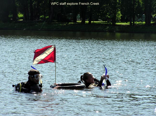
| French Creek |
| Little Mahoning Creek |
| Past Issues |
| Home |
�
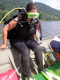
WPC Studies Biodiversity in French Creek’s Ten Major Tributaries
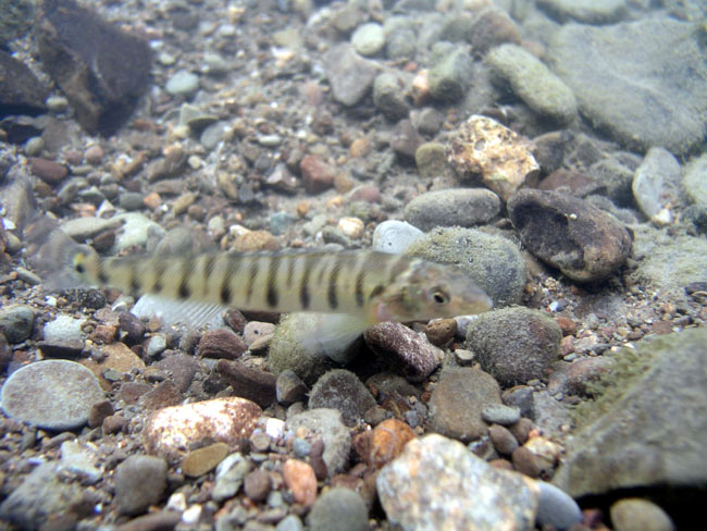
French Creek originates in western New York and flows 117 miles to its confluence with the Allegheny River at Franklin, Pennsylvania. It is perhaps the most ecologically significant waterway in the state, containing more species of fish and freshwater mussels than any other similar-sized stream in the northeast United States:
- The federally endangered clubshell and northern riffleshell mussels have
been lost from more than 95 percent of their historic ranges, yet both
maintain healthy populations in the French Creek watershed.
- Thirteen additional mussel species in the French Creek watershed are
considered rare, threatened, or endangered in Pennsylvania.
- Threatened or endangered fish found in the French Creek watershed include several madtom and lamprey species, as well as eight of the 15 species of darters.
Threats imposed by improper land use, degraded habitat and pollution, resulted in an immediate need to better understand these aquatic communities and their requirements for survival. This was the impetus for WPC’s biodiversity study of the ten major tributaries that feed into French Creek. The project, slated for completion by the end of 2008, will aid in the conservation of French Creek’s natural resources and help improve land use decisions.
“We wanted to expand our research into the major tributaries of French Creek to help complete our understanding of the French Creek watershed as a whole,” said WPC Aquatic Ecologist Tamara Smith.
WPC modeled the French Creek Tributaries Biodiversity Study after a
previous project that documented freshwater aquatic communities in
the mainstem of French Creek from 2003 until 2005 (funded by the PA
State Wildlife Grant and administered by the Pennsylvania Fish and Boat
Commission and Pennsylvania Game Commission).
WPC used Global Positioning System (GPS) and geographic information system (GIS) technology to map in-stream habitats in each of the ten major tributaries of French Creek. Additional features, such as the locations of discharge pipes and invasive aquatic plant and animals, were mapped as well. Every half-mile, WPC staff conducted a detailed streamside habitat assessment. As of this fall, WPC has mapped approximatelyabout 80 miles of stream, conducted surveys for freshwater mussels at 25 tributary sites, and returned to each of those sites to conduct fish and aquatic insect surveys.
Information from this study will also enable WPC and other conservation organizations, as well as county conservation districts, state and federal agencies, and municipalities to better use limited funding for stream conservation by focusing conservation investments on the most critically imperiled habitats and the areas that are most important to rare and threatened aquatic species. WPC hopes that the project will enable the recovery of federal- and state- listed species of special concern and protect the unique biodiversity of French Creek.
For more information, email [email protected] or contact WPC’s Northwest Field Station at 814-739-9991.