
Remote but Rewarding
Harris Bridge Access Point, McConnells Mill
With its restored mill, covered bridge, and boulder-lined creek gorge, McConnells Mill State Park is one of the most popular parks in Western Pennsylvania.
Harris Bridge, located some distance from the main park facilities on one of McConnells Mills’ southernmost tracts, offers a more remote outdoor experience within this National Natural Landmark.
“Harris Bridge is the takeout for one of the best whitewater runs on Slippery Rock Creek, which flows best in the spring, but can be paddled year-round if conditions allow,” said Eli Long, GIS specialist for WPC’s Watershed Conservation program. “This access to the creek, a trout-stocked fishery, is also popular with fishermen and hikers as trails lead one up the gorge to further solitude. The unique watercarved geology of the gorge is especially apparent as you walk upstream from the bridge, but be cautious as it is rugged walking and the area truly is remote.”
The Conservancy funded improvements to a river access site near Harris Bridge in 2009 through the Canoe Access Development Fund, which is made possible through the generosity of longtime WPC members Roy Weil and Mary Shaw. Partnering with the Park and with work crews from Butler County Department of Corrections, WPC realigned existing boulders to create steps to the water level and armor the access site against further erosion. “The improvement blends perfectly with the surroundings due to the use of found materials at the site,” said Long.
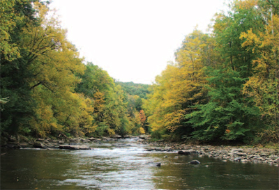
Slippery Rock Creek — the view from Harris Bridge
“Ideally, visit the park in the fall, when the autumn leaves are in their full glory, as the flowing creek, rugged gorge and foliage create a beautiful scene. Explore a little and you can certainly find an out-of-the-way place to make you feel as if you have the park to yourself.”
The Western Pennsylvania Conservancy’s history with McConnells Mill State Park stretches back to its very beginning. Ownership of the land that became the park transferred from Thomas H. Hartman to WPC in 1942. The Conservancy then transferred the land to the Commonwealth of Pennsylvania in 1957 when McConnells Mill State Park was formally dedicated.
Directions: Travel south from the
park on Route 19 to Portersville,
turning right onto Route 488 West. From that highway, the
road to Harris Bridge cuts off to the right and travels several
miles before dropping down into the gorge.
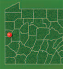
GPS coordinates: -80.21684 40.91213
Read about another "Remote but Rewarding" destination, Glade Run.