
Secluded Fishing & Swimming Spots
The Blue Hole
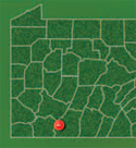
A rather deep swimming hole in Somerset County, the Blue Hole can provide hours of recreation, including swimming and creek exploration. Located in Blue Hole Creek within Forbes State Forest, the Blue Hole can be accessed by a short walk from the Grindle Ridge shelter area of the Laurel Highlands Trail, or a scenic drive along state forest roads.
This location will be included as one of several recreational opportunities in the Casselman River Watershed Water Trail and Recreation Guide that the Western Pennsylvania Conservancy plans to complete in 2011.
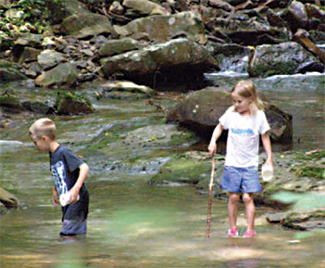
Generations of children have explored the Blue Hole.
“I first visited the site as a child after hearing stories from my father about a swimming hole the scout troop discovered during one of many hikes along the Laurel Highlands Trail,” said WPC Watershed Planning Coordinator Carla Ruddock. “Revisiting this site during development of the Casselman River Water Trail and Recreation Guide brought back memories of youthful days jumping from what I remembered as large boulders into the cool, refreshing, blue-colored water and playing in the creek as I searched for crayfish.”
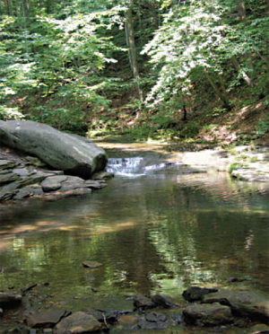
Although beautiful during autumn, winter, and spring, the Blue Hole is most frequently visited by locals during the hot days of summer.
Other nearby attractions include Cole Run Falls, Laurel Ridge State Park, Laurel Hill State Park and Laurel Highlands Trail.
Directions: From Normalville: Take Route 653 east towards New Centerville. After passing through a portion of Laurel Ridge State Park and crossing into Somerset County, turn left onto Covered Bridge Road, then left onto Fall Run Road. Turn left onto Blue Hole Road and follow it a short distance. There will be small roadside pull-offs for parking.
From Somerset: take Route 281 south to New Centerville,
where you will turn right onto Route 653 west. Turn right onto
Ream Road and follow to the intersection with Covered
Bridge Road where you will turn right, then left onto Fall Run
Road. Turn left onto Blue Hole Road and follow it a short
distance. There will be small roadside pull-offs for parking.
GPS coordinates: -79.29825 39.97232