West Branch French Creek Conservation Area
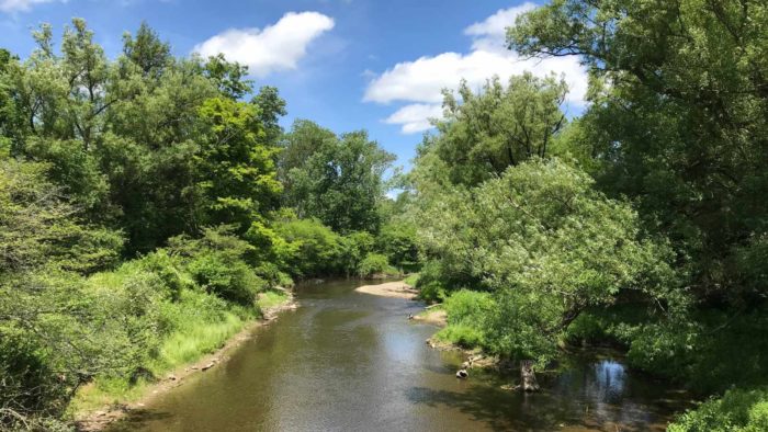
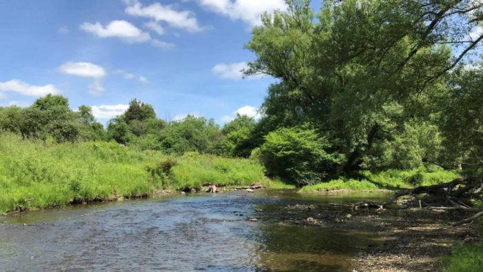
The Conservation Area includes a variety of upland and wetland areas and more than 6 miles of frontage along the West Branch of French Creek. There are extensive areas of forested wetlands, including oxbows and old side channels, which provide important habitat for a diversity of plants and animals.
Within the Conservation Area is a unique shrub-fen community known as Lowville Fen. Fens are permanent wetlands fed by calcium-rich groundwater that support species requiring a high pH. As fen ecosystems are rare in Pennsylvania, and limited to the glaciated northwestern region, they contain many rare plant species endemic to these areas. These species include highbush-cranberry, alder-leaved buckthorn, leafy northern green orchid, slender cotton-grass, and mud sedge.
Location
- Venango Township, Erie County
- Greenfield, County
Dates Acquired
1996 - 2025
Size
Approximately 1,138 acres
Notable features
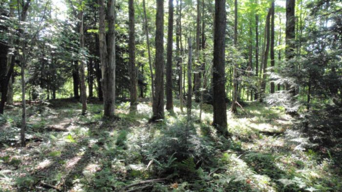
Slow-moving stream, floodplain and associated wetlands, alkaline fen, beaver ponds, hemlock forested wetland
Parking
Parking Available
Recreational Activities
- Eating Area / Benches
- Fishing
- Hiking (Designated Trail)
- Hiking (Off-Trail)
- Hunting
- Kid-Friendly
- Paddling
- Universal Access / ADA Trail
- Wildlife Watching
- Birding
Recreational Activities
Outdoor eating/picnicking
From the parking area off Rt. 8, a short, paved, handicapped-accessible path leads to a covered pavilion containing tables and grills.
Hiking
Also from the parking area, a 1.1-mile loop unpaved hiking trail leads north to a series of picturesque beaver ponds. A rough-hewn log boardwalk, or puncheon, traverses a wetland located just below a beaver dam. The trail then turns to circle an old Christmas tree plantation, and skirts along the edge of the West Branch French Creek floodplain. Depending on the season, portions of the trail may be quite wet. From Half Moon Road, visitors can walk along an old farm road through old fields and a reclaimed gravel mine to reach the edge of the floodplain forest. At the end of the trail, a stone bench overlooks a small pond and wetland.
Hunting and Fishing
Both hunting and fishing are permitted in accordance with state regulations, although hunting is not permitted on Sundays. Please exercise caution and wear blaze orange during hunting season. Trapping is not permitted.
Birding
West Branch French Creek Conservation Area is an eBird hotspot! eBird hotspots are the best places for birding around the world. Golden crowned kinglet, bald eagle and American kestral are just a few of the many species spotted here.
eBird.org is a website and app you can use to: find more birds; keep track of your bird lists, photos, and sounds; explore the latest sightings from around the world; join the world’s largest birding community; and contribute your observations to science and conservation. Visit eBird.org for more information, directions to hotspots and more.
Plan Your Visit
Directions
The main trailhead access is from Rt. 8, near the village of Lowville, approximately 4 miles north of Wattsburg, Erie Co., PA. Look for a dirt and asphalt pull-off on the east side of the road. Other portions of the conservation area may be accessed from Phillipsville Road, Page Road, Half Moon Road, and Wildman Road.
Visitor Tips
Watch this introduction to West Branch French Creek Conservation Area
Hiking the trail requires negotiating steps, a narrow plank crossing and steep slopes. Wear sturdy boots or shoes, and bring water. Be prepared for your visit by watching this short video about this natural area and reviewing the downloadable maps and materials below. We recommend downloading these files to your mobile device prior to visiting.
Visitor Guidelines
When visiting West Branch French Creek Conservation Area, please remember:
- Only foot-traffic is permitted.
- Camping and campfires are prohibited.
- If you carry it in, carry it out.
- Dogs must be on a leash or otherwise kept under control at all times.
- Collecting (animals, plants, rocks, etc.) without permission is prohibited.
- Review the Guidelines for Public Use of WPC Properties document prior to your visit