The Upper Allegheny Region comprises the drainage of the Allegheny River as it flows northwest from a spring in Potter County into New York State before bending southwest to the Kinzua Dam on its way to Pittsburgh. Along this path, it inherits a litany of fishing-destination streams: Potato Creek, Tunungwant Creek, Kinzua Creek, Brokenstraw, Tionesta, Oil Creek, French Creek and the Clarion.
The region includes a mix of glaciated and unglaciated landscapes that supports some of the most diverse, productive and scenic forests and rivers in the Eastern United States. At the heart of the region is the 500,000-acre Allegheny National Forest, Pennsylvania’s only national forest and a linchpin of a 7,600 square mile mosaic of wilderness, working forests, wetlands and farmland that make up the Upper Allegheny Region.
Clarion River
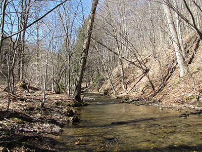
The Clarion River flows nearly 100 miles from its headwaters in McKean County to its confluence with the Allegheny River near Foxburg. Once considered one of the most polluted streams in the state, the Clarion River has recovered to become an important recreational destination. In 1996, a 52-mile section from Ridgway, Pa. to the Piney Dam was federally designated as Wild and Scenic. Bald eagles now nest along the river and sightings of ospreys and otters are common.
Since 1977, we have conserved more than 13,000 acres along the Clarion River Corridor. Most of this property has been made part of the Pennsylvania’s public lands system, including Clear Creek and Cook Forest state parks, state forest lands, state game lands and the Allegheny National Forest.
French Creek
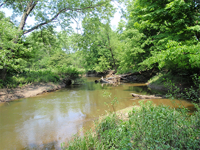
The French Creek watershed is a 1,250-square mile watershed that flows from its headwaters in Chautauqua County, N.Y. to its confluence with the Allegheny River in Franklin, Pa. It is the most biologically diverse stream of its size in Pennsylvania or any state in the northeastern United States, containing more species of fish and freshwater mussels.
French Creek and its tributaries are home to four federally endangered freshwater mussel species, known as the Northern riffleshell (Epioblasma torulosa rangiana), rayed bean (Villosa fabalis), snuffbox (Epioblasma triquerta) and the clubshell mussel (Pleurobema clava), as well as one federally threatened freshwater mussel species, known as the rabbitsfoot (Quadrula cylindrical cylindrical). There are about 86 species of fish that call the watershed home.
Historically, the Ohio River drainage (including the Allegheny River system) was one of the most biologically diverse river systems in the nation with respect to aquatic species. In the last 100 years, human impacts to these watersheds have resulted in the loss of many species, thereby leaving French Creek as the best representative of historical biodiversity in the Pennsylvania portion of the Ohio River basin. WPC’s Natural Heritage work in French Creek has produced a thorough understanding of the status of living resources in this area. The Conservancy has been involved in the French Creek watershed since the late 1960s.
Land protection efforts continue to date with over 5,000 acres permanently protected. These properties are maintained as natural areas and all of our properties in this area are open to the public for outdoor recreation that includes hiking, hunting, fishing, canoe and kayaking and bird and wildlife watching. The French Creek watershed also includes the more than 8,000-acre Erie National Wildlife Refuge and four Audubon Society Important Bird Areas.