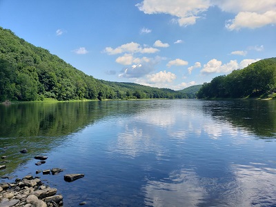
 For the third time in as many decades, the beautiful and dynamic Allegheny River has been named Pennsylvania’s River of Year by the PA Department of Conservation and Natural Resources and the PA Organization for Watersheds and Rivers. The accolades, given in 1994, 2017 and 2024, are a testament to the Allegheny’s vitality and importance to our region.
Since 1965, the Western Pennsylvania Conservancy has supported the river, and its recovery, by protecting land in the watershed to safeguard habitats and biodiversity for native wildlife, and restoring the river and its tributaries to improve water quality for aquatic and terrestrial species. Read on to discover this important legacy for one of the most valuable river systems that’s improving the quality of life in Western Pennsylvania.
“Like no other river on earth”
A river is never the same place twice as it moves through different landscapes, its composition continuously influenced by its tributaries.
In the 325 miles between the Allegheny River’s source as a spring in Potter County, briefly arcing into New York until joining with the Monongahela River in Pittsburgh to form the Ohio River, the Allegheny winds through forest valleys, farmland, towns and cities. It is free-flowing for more than 125 miles from the Kinzua Dam in Warren County to East Brady in Clarion County. An 87-mile section is a federally designated National Wild and Scenic River, containing seven islands protected under America’s National Wilderness Preservation System and giving the Allegheny its recognition as a globally significant river.
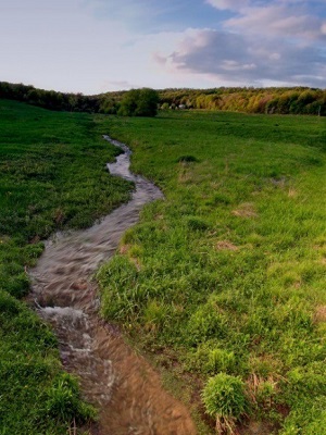 According to Charles Bier, WPC conservation scientist emeritus, “There is no other river on earth like the stretch of the Allegheny between Kinzua Dam and Brady’s Bend. The recognition is due not only to the endangered and threatened species found there, but also for the abundance of them, and for the overall richness of aquatic life in this stretch of the river.”
The Allegheny River has played a supporting role in the region’s economic history for centuries, serving as a transportation route for logging, tanning and pulp mills, coal, petroleum and natural gas extraction, steel mills and other industries. Despite these challenges, it is a biologically diverse watershed, and supports more than 80 species of globally rare plants, vertebrates, invertebrates and aquatic communities.
Today, thanks to concerted efforts by the Conservancy and state and regional conservation organizations, one can find a growing bald eagle population, imperiled species such as the eastern hellbender, and some of the world’s rarest freshwater mussel species.
Protecting the Shoreline and Forests
The Upper Allegheny region is scenic, rugged and vastly wooded, containing some of Pennsylvania’s last remaining old-growth tracts. Here the Allegheny River borders the northern edge of the 500,000-acre Allegheny National Forest (ANF), Pennsylvania’s only national forest. Established in 1923 to protect the watershed, the ANF was already so depleted by logging by that time that the landscape in many places was barren and the area was nicknamed the “Allegheny Brush-Patch.” Thanks to restoration efforts by the U.S. Forest Service, the forest recovered significantly by the 1940s.
In 1965, the Western Pennsylvania Conservancy commissioned a study to set criteria for land protection in the Allegheny River watershed, which encompasses 11,580 square miles. Conservation goals included helping the ANF acquire land within its new boundary on the west side of the river and purchasing key interior properties, islands and shoreline areas. In 1972, a group of Conservancy staff and members took a four-day exploratory canoe trip on the Allegheny to develop a water trail to encourage recreation on the river. They found few areas to camp that weren’t private property, but they encountered families who had owned the land for generations and wanted it to stay intact. WPC began land protection work in the region in earnest, and by 1981 acquired nearly 9,000 acres, including 16 islands and key shoreline areas; most of the land was adjacent to the ANF.
Life in the Allegheny National Forest
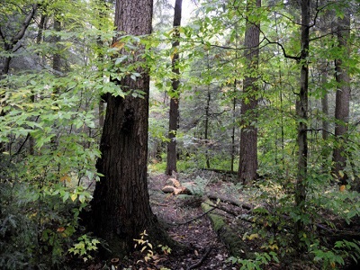 The forest has 300 vertebrate species, and the coldwater streams and 40 miles of river within the ANF contain more than 70 fish species, including brook trout, walleye, smallmouth bass, muskellunge, northern pike and yellow perch.
In the 1990s, WPC scientists partnered with the Carnegie Museum of Natural History to study forest insects and establish a baseline for future studies of living organisms in the forest.
The Conservancy was instrumental in conserving two key properties in the ANF. In 1984, WPC helped protect the Hickory Creek Wilderness Area in Warren County, the first federally designated Wilderness Area in Pennsylvania, by acquiring the mineral rights under the 9,425 forested acres from more than 90 subsurface owners. In 1987, WPC completed another complex land transaction to add to the Tionesta Research Natural Area, the largest and oldest tract of essentially virgin forest between Maine and the Smoky Mountains—some trees are 500 years old. To protect the forest from development, the Conservancy acquired oil, gas and mineral rights for this 2,100- acre natural area from several private owners and transferred them to the U.S. Forest Service.
Beyond the forests that surround the upper Allegheny River, a unique feature of the river is its series of islands that provide prime habitat for wildlife. The islands were formed by rich glacial sediment deposits as one of the region’s last glaciers melted. The back-channel areas around the islands provide a calmer environment for aquatic life and the islands themselves provide habitat for many species, including bald eagles, herons and songbirds. To ensure that this habitat is available for wildlife in the future, the Conservancy has protected 22 river islands from Warren to nine miles upriver from Pittsburgh, totaling more than 500 acres.
Protecting the Allegheny’s Tributaries
WPC has protected more than 100,000 acres in the Allegheny River watershed, including its tributaries and more than 20,000 acres of islands, shorelines and valleys.
The Allegheny’s largest tributaries include the Clarion River and French Creek, significant watersheds of their own. The Clarion River, bordering the southern edge of the national forest, was described in the early 1900s as flowing “black like ink” with industrial pollution and nearly devoid of aquatic life. The Conservancy began protecting land along the Clarion River in 1976, and in the 1980s, focused on a 40-mile river corridor from Ridgway in Elk County to Piney Dam in Clarion County.
With help from the Clean Water Act and better compliance by industry, the river had recovered enough by the late 1990s that a 51.7-mile portion was designated a National Wild and Scenic River. To date, the Conservancy has protected 13,000 acres along the Clarion River, and the region remains a priority for our land and water conservation efforts.
In contrast, French Creek, which flows into the Allegheny River at Franklin, does not have a history of degradation and is one of the most biologically diverse watersheds in Pennsylvania, containing more species of fish and freshwater mussels than any other comparably sized stream in the northeastern U.S. The Conservancy was a founding member of the French Creek Project in 1995 (a partnership with Allegheny College, Pennsylvania Environmental Council and, later, The Nature Conservancy), to raise public awareness and promote and coordinate regional conservation efforts.
In the 2000s, WPC staff conducted a streamside habitat assessment and fish and aquatic insect surveys in French Creek and each of ten tributaries, mapping 80 miles of streams. Since 1969, WPC has protected more than 5,000 acres in the French Creek watershed, including shoreline, critical wetlands and parts of the Lake Pleasant watershed and Conneaut Marsh. We continue to partner with many organizations through the French Creek Collaborative to maintain the exceptional health of the watershed through science, planning, land conservation and education. Watch a free webinar, “Discover French Creek,” about our work there.
Restoring and Protecting the Watershed’s Vitality
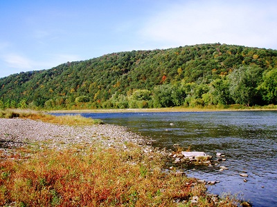 The water quality of any major river depends on its tributaries, and the Allegheny’s dozens of tributaries vary in levels of health. Although some streams within the large watershed have seen improvements in water quality, the number of impaired streams is significant due to long-lasting impacts from industrial activities, agricultural run-off, stormwater discharge, acid rain, sediment from dirt and gravel roads, and human development. In tandem with WPC’s land protection program, the Conservancy’s watershed conservation program works with a multitude of partners to actively restore and protect water quality of the Allegheny River and its tributaries.
In 2006, the Conservancy undertook the first depth-mapping, or bathymetry, of the Allegheny River. A topographic map was created for nearly 75 river miles from near Parker, Pa., to the turnpike bridge in Harmarville. This map provided valuable data on river bottom habitat for conservation projects. The Conservancy has completed nearly 100 Unassessed Water surveys in the Allegheny National Forest to find previously unknown populations of native brook trout, and conducted freshwater mussel surveys at least 54 sites in the Allegheny River and its tributaries, including SCUBA exploration of Kinzua Lake. The surveys provided data for many restoration projects with the U.S. Forest Service and others.
The Conservancy is active in the Allegheny Watershed Improvement Needs (WINS) Coalition, formed in 2007. This vital partnership of nonprofits, government agencies and volunteers protects and restores habitat in the watersheds of the Allegheny National Forest. The dozens of group projects each year include water quality monitoring, large-scale litter and invasive plant removal, streambank stabilization, riparian tree planting, dam removal, installation of passive acid mine drainage treatment systems and other restoration methods.
From May 2012 to April 2016, WPC planted 19,164 trees planted along more than 54,000 feet of streambank in the Allegheny River Watershed, totaling nearly 85 acres.
Stream Restoration Work
The Conservancy’s watershed work also includes restoring streams to a natural, free-flowing state. Through our fish monitoring work with the U.S. Forest Service on East Branch of Tionesta Creek, it was discovered that seven of the creek’s nine tributaries contained wild trout populations separated by aging and undersized road culverts. We replaced eight culverts with much larger ones, allowing fish passage and reconnecting the streams to the creek. We made improvements to the dirt and gravel road system, resulting in a significant increase in trout populations in those tributaries.
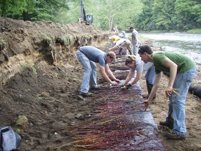 We also completed streambank stabilization work along the Wild and Scenic portion of the Clarion River. We planted live cuttings of woody riparian plants, primarily willows and dogwoods, horizontally along 500 feet of the streambank to provide natural “root rebar” to hold the soil in place. This “soil bioengineering” establishes a quick-growing layer of shrub growth along the stream to slow water velocities in high flow and reduce erosion. On nearly an acre of the upper stream area, we planted more mature saplings.
Brokenstraw Creek in Warren County, a major tributary to the Allegheny River, contains some of the most outstanding glacial wetlands in the state and is a popular recreational stream—but it also contains mercury that washes into the creek through erosion. In 2017, the Conservancy stabilized more than 4,000 feet of streambank at nine sites, preventing an estimated 224 tons of soil loss each year.
Freshwater Mussels Filter the Water
The Allegheny River also gets help from creatures living in its water. The river has an amazing density of freshwater mussels, including high numbers of some endangered species. A healthy population of mussels has the ability to filter billions of gallons of water per day. In 2015-16, the Conservancy was involved in the largest federally endangered mussel relocation project in U.S. history. The pending demolition of the Hunter Station Bridge over the Allegheny River in Forest County prompted PennDot and its partners, including the Conservancy, U.S. Fish and Wildlife Service, the PA Fish and Boat Commission and others, to tag and transfer 90,805 federally endangered mussels from the Allegheny to rivers in seven states and the Seneca Nation of Indians whose mussel populations were low or nearly nonexistent. We transplanted more than 34,000 common species mussels to the Clarion and Ohio rivers to help reestablish those populations. Read about the project on pages 6 and 7 of the winter 2015 issue of Conserve.
The Conservancy’s “Downstream” Work – Managing Stormwater
 If you’ve ever fished, canoed or camped along the Allegheny, you have most likely enjoyed the upper and middle sections of the river. As it progresses from Emlenton towards the Ohio River, it is heavily impacted by industry, pollution and sewage. Once in the Pittsburgh metropolitan area, dense population, impervious surfaces and outdated sewer infrastructure allow stormwater to wash pollutants directly into the river, even as it remains a popular fishing and recreational river.
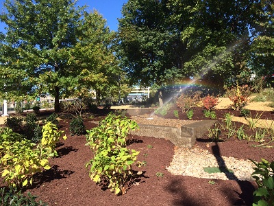
In the Pittsburgh region, the Conservancy’s community greening program helps mitigate these negative impacts by using natural features like street trees and native plantings to capture, filter and slow the release of stormwater that enters the river. In some cases, we plant street trees in large trenches that serve as underground bioretention systems.
With partners and volunteers, we have conducted large-scale tree plantings in neighborhoods that border the Allegheny River, downtown Pittsburgh and along the Three Rivers Heritage Trail to Point State Park. We have also constructed bioswales, which are wide, shallow engineered areas that include depressions planted with native trees and other plants. In the flood-prone community of Millvale, the Conservancy created two bioswales, including a meandering 400-by-15 foot-wide bioswale along Hawthorne Road on the Sisters of St. Francis’ Mount Alvernia campus that mimics a natural streambed. In addition, we’ve planted more than 850 trees throughout the borough. In Point State Park downtown, we constructed a bioswale to capture rainwater and serve as an educational model for visitors.
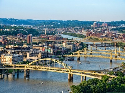 The Allegheny River’s journey through Pennsylvania reflects our region’s history. It has served myriad functions and sustained many industries through time. Although it has endured multiple impacts, the river still supports an abundance of wildlife and plants and offers exceptional recreational opportunities. It’s part of our cultural identity and a powerful force in our landscape. With the shared vision and efforts of many partners and loyal support of donors, the Western Pennsylvania Conservancy will continue our multidimensional work to protect the Allegheny River watershed for future generations.
###
About the Western Pennsylvania Conservancy:
The Western Pennsylvania Conservancy (WPC) enhances the region by protecting and restoring exceptional places. A private nonprofit conservation organization founded in 1932, WPC has helped establish 11 state parks, conserved more than a quarter million acres of natural lands, protected or restored more than 3,000 miles of rivers and streams, and assessed thousands of wildlife species and their habitats. The Conservancy owns and operates Frank Lloyd Wright’s Fallingwater, which is on the UNESCO World Heritage List and symbolizes people living in harmony with nature. In addition, WPC enriches our region’s cities and towns through 130 community gardens and other green spaces and thousands of trees that are planted with the help of more than 7,000 volunteers. The work of the Conservancy is accomplished through the support of more than 10,000 members. For more information, visit WaterLandLife.org or Fallingwater.org.
